Robin and I decided to take our long holiday in 2014 to Wales. We really had not spent a lot of time in the United Kingdom since moving to Amsterdam since 2008, so we figured it was time for us to return. Our goal was to mix a variety of active days (mostly hiking), with visits to castles, manor houses, gardens and trains.
Knowing that we were starting our trip in the village of Capel Curig (staying at the excellent Bryn Tyrch Inn), I searched the Internet for hikes near by. The official website of Snowdonia National Park had a good list of hikes and walks of various difficulty levels and they happened to have a “hard leisure walk” starting from Capel Curig: Crimpiau. A check for geocaches in the area showed that there were three of my favourite type (difficulty 2 / terrain 3.5) near the hiking route (note that all three are premium geocaches and only available to premium Geocaching.com members):
We had excellent weather on the day; in fact, I did not put enough sunscreen on my arms and got a good sunburn in a few exposed spaces. The hike itself was a nice mix of forests, valleys, climbs to passes and a bit of scrambling to get the three geocaches. The walk up to the pass and the views to Llyn Crafnant were particularly nice.
All in all, a recommended hike in the region if you are looking for a hike with moderate elevation gain and loss and a variety of scenic options.
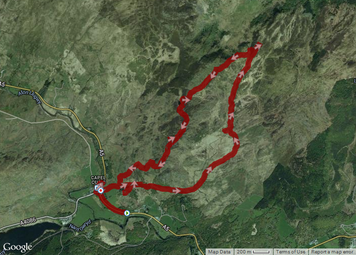
Download the gpx file of our hike.
Distance: 10.84 km; Elevation Gain: 300 m; Elevation Loss: 300 m
